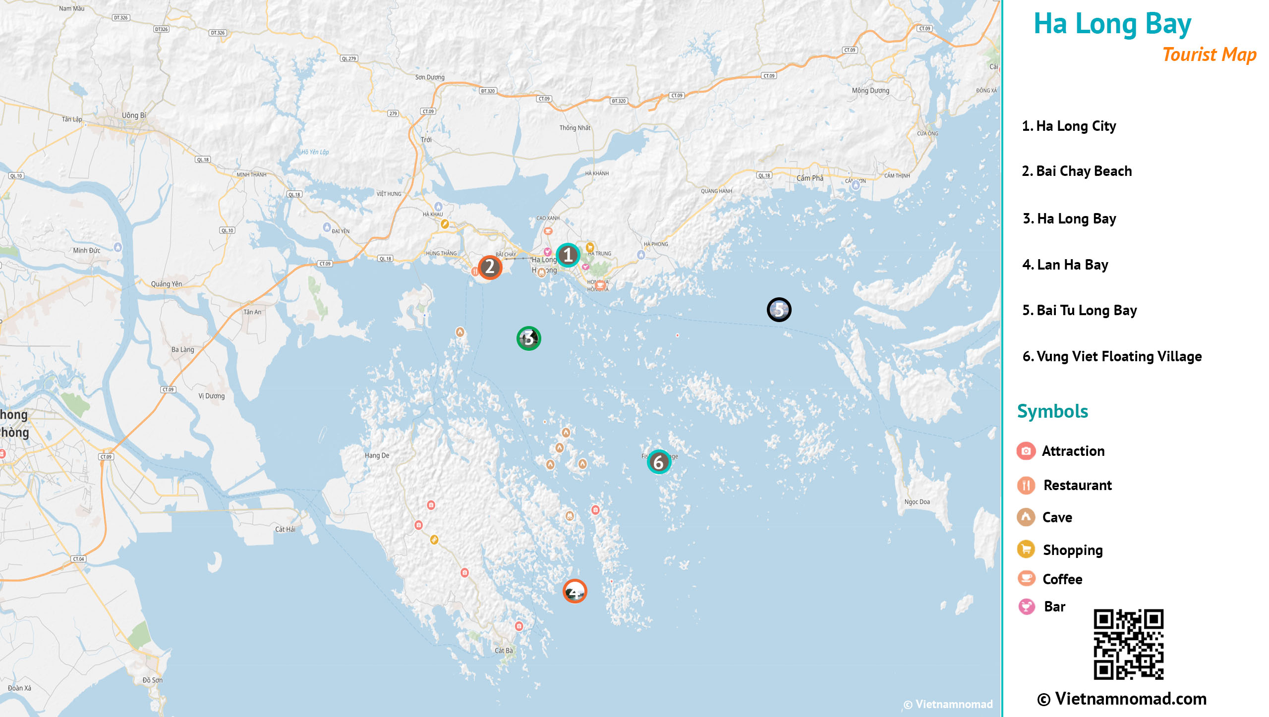
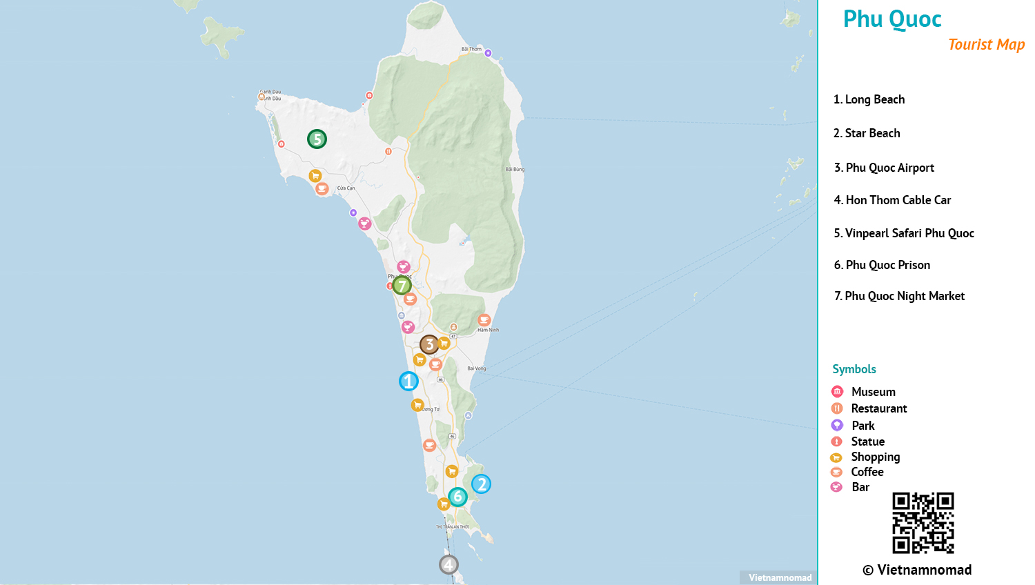
Vietnam maps
Vietnam stretches over 1,650 km from north to south, offering diverse landscapes and vibrant cultures along the way. These maps are designed to guide your journey.
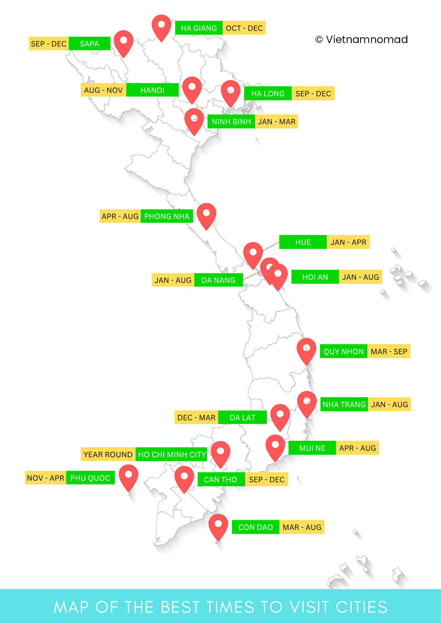
Download Vietnam maps
Download these free, high-quality PDF maps by typing “Vietnam maps” in the AI chatbot (AI•Companion), or get the premium high-resolution version here.
With AI•Companion (the chat bubble on the right side of your screen), you can explore a library of travel images and maps, and chat with your own personalized AI travel assistant—designed to make your Vietnam journey easier and more inspiring.
Vietnam map with regions
As of July 2025, Vietnam has consolidated its administrative boundaries, reducing the number of provinces and centrally governed cities from 63 to 34, including 6 centrally administered cities.
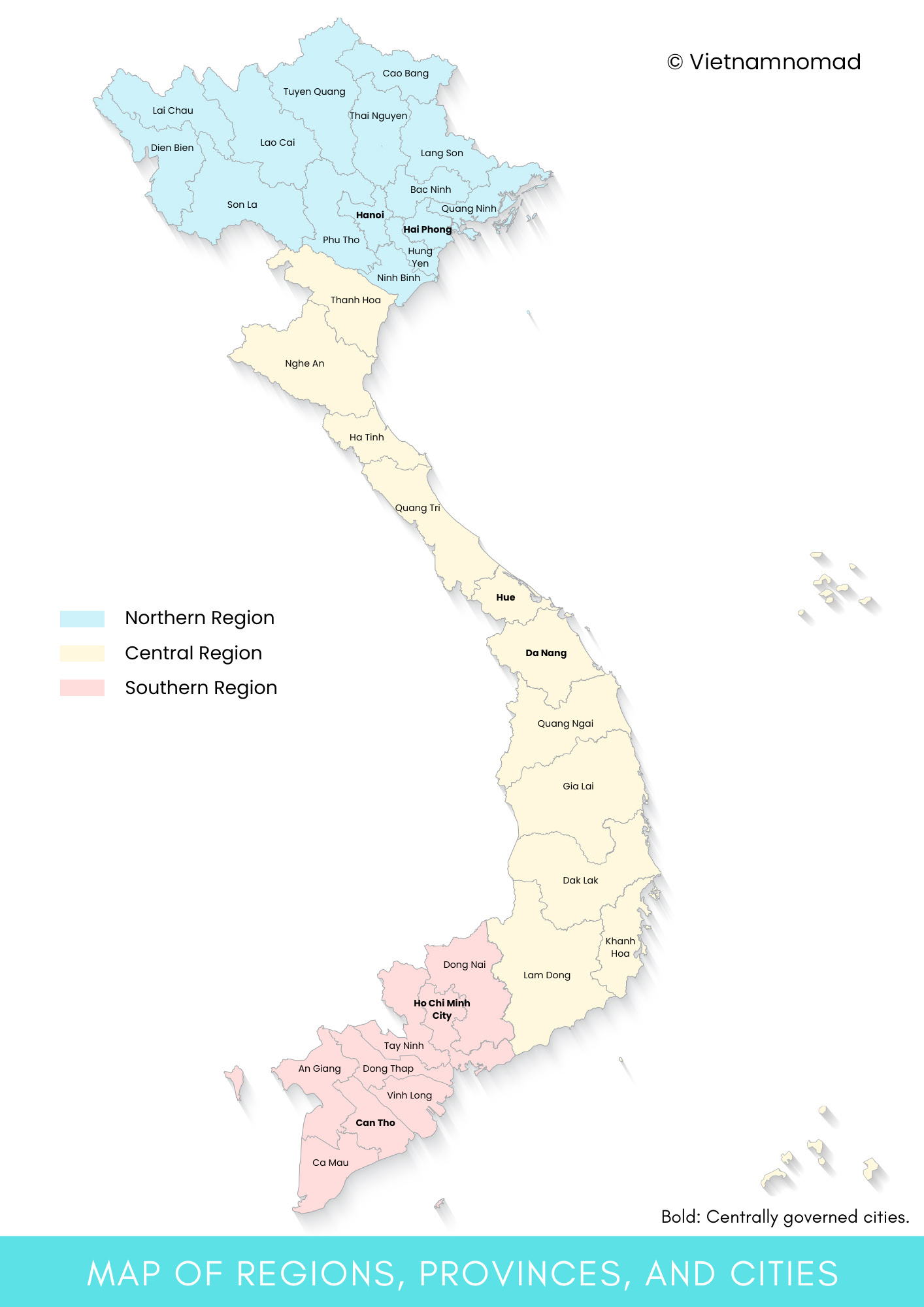
Download the Vietnam map with regions, provinces, and cities >
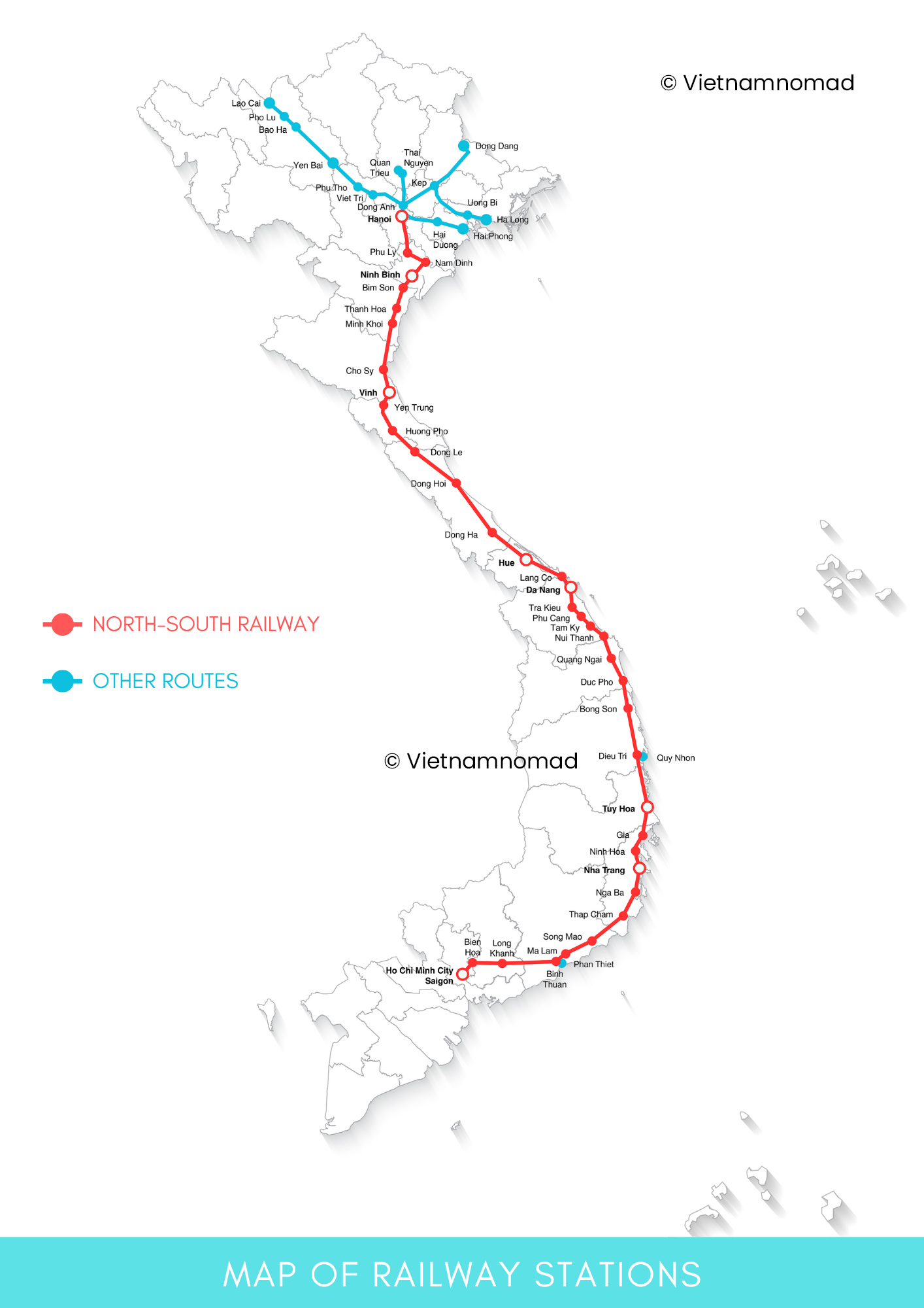
Map of railway stations in Vietnam
This map includes the routes and main railway stations in Vietnam.
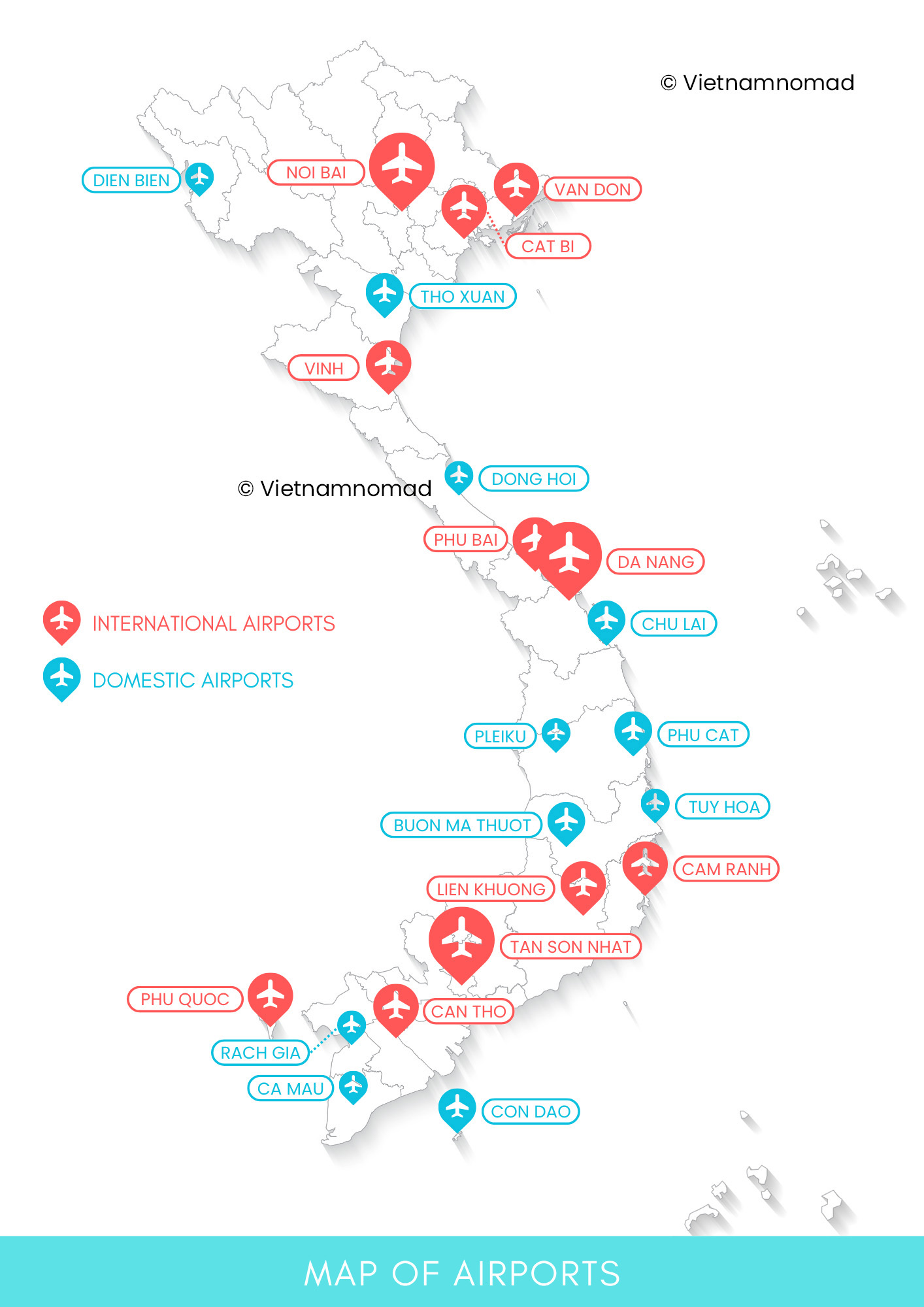
Map of airports in Vietnam
Vietnam has a total of 22 civilian airports, including 11 international airports. This map shows both international and domestic airports in Vietnam.
Learn more about airports in Vietnam >
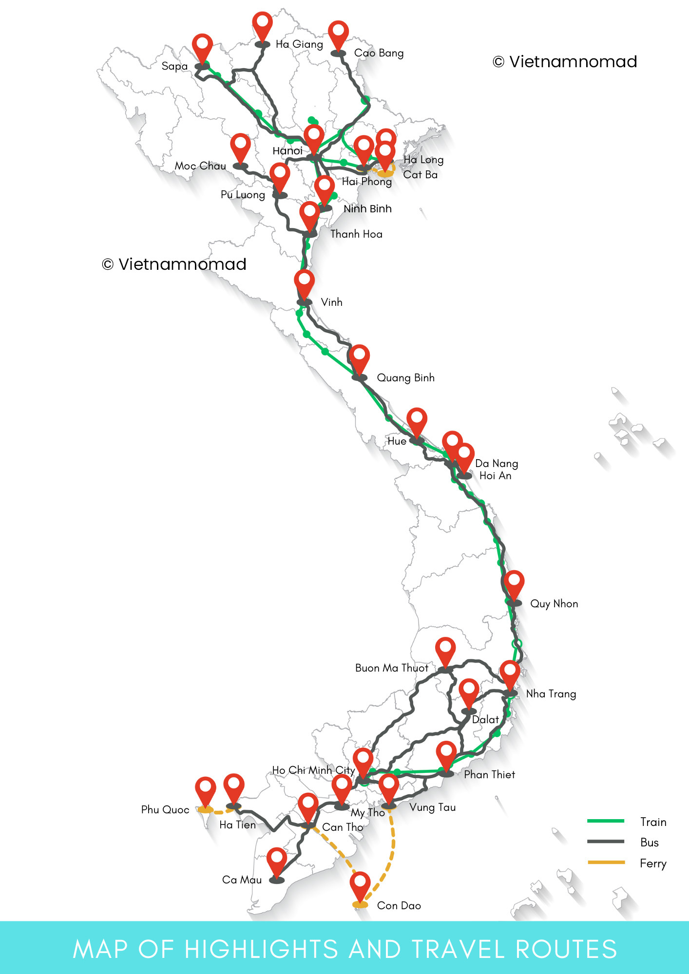
Vietnam map with highlights and travel routes
This map includes popular destinations in Vietnam and the connecting routes between them.
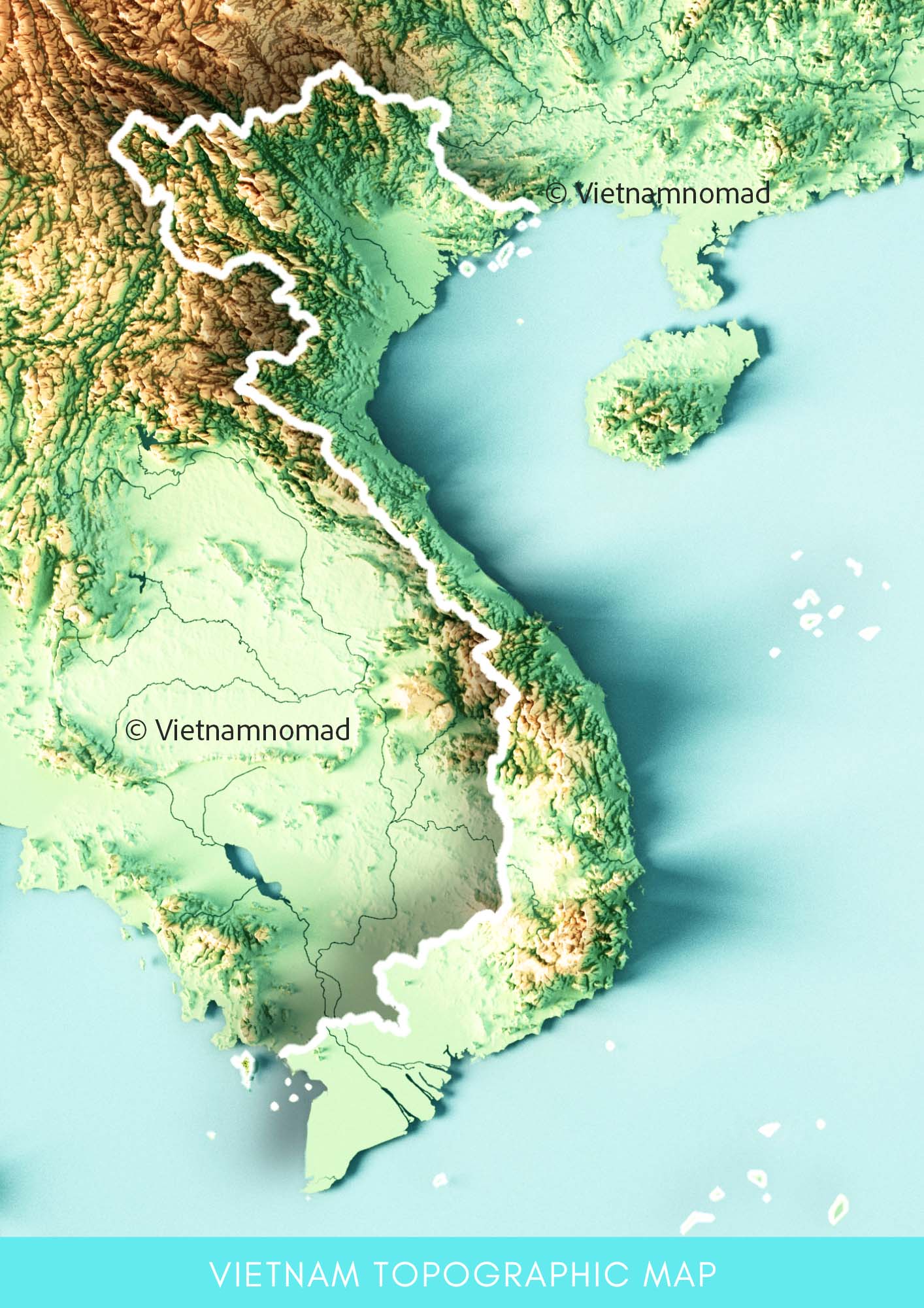
Vietnam topographic map
This is a 3D-rendered topographic map of Vietnam.
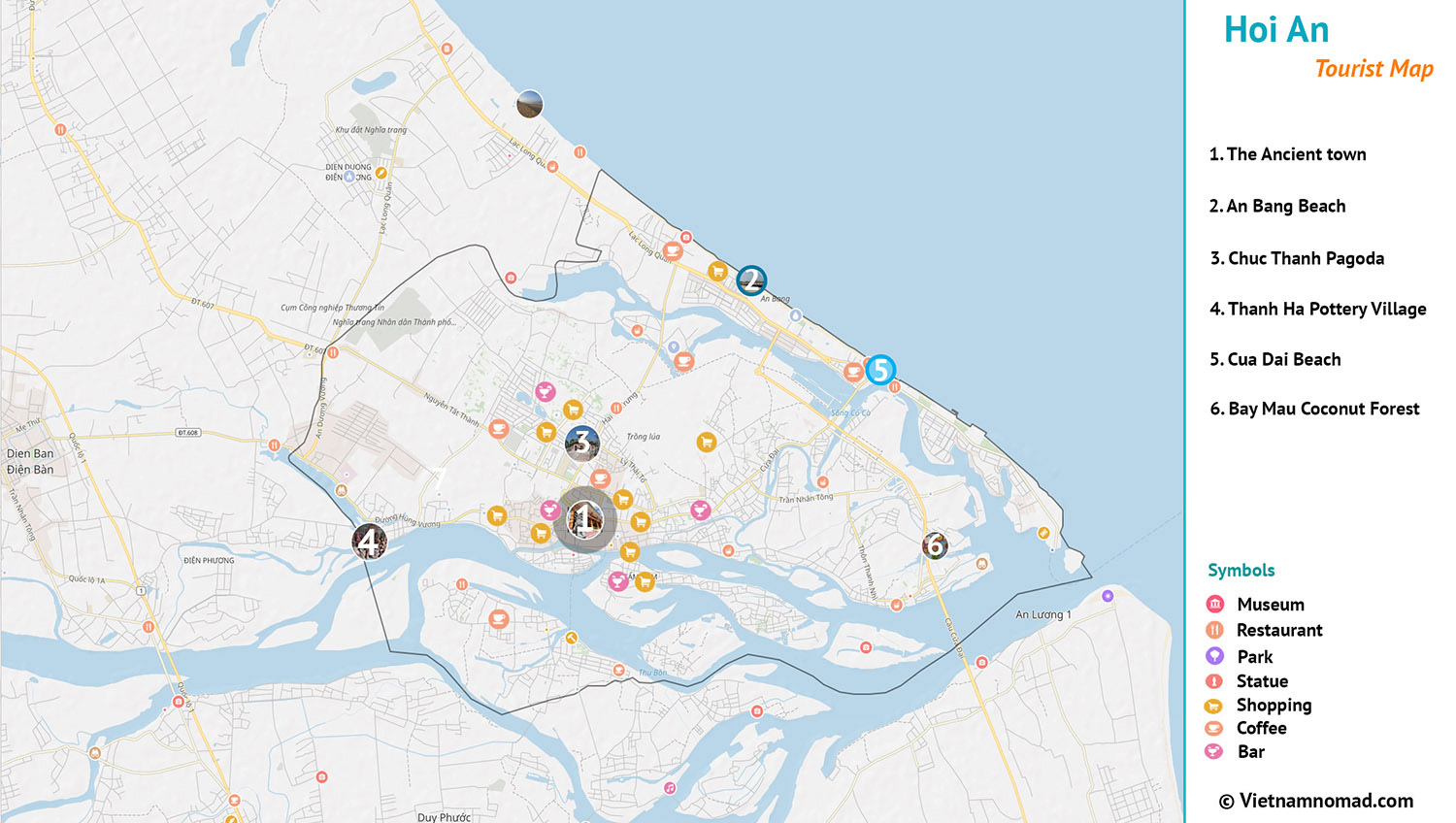
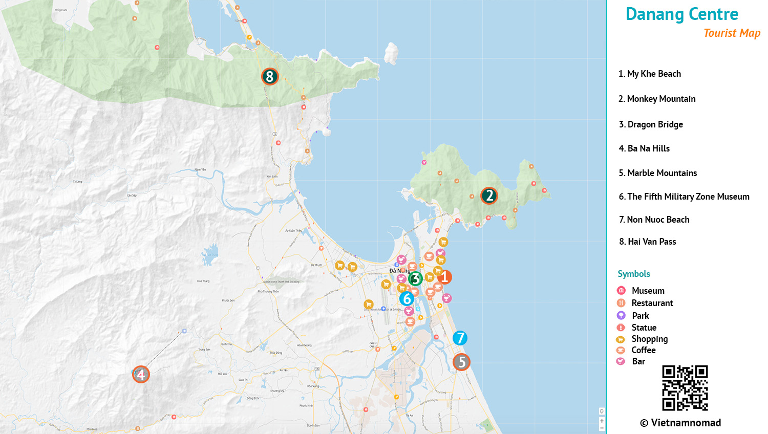
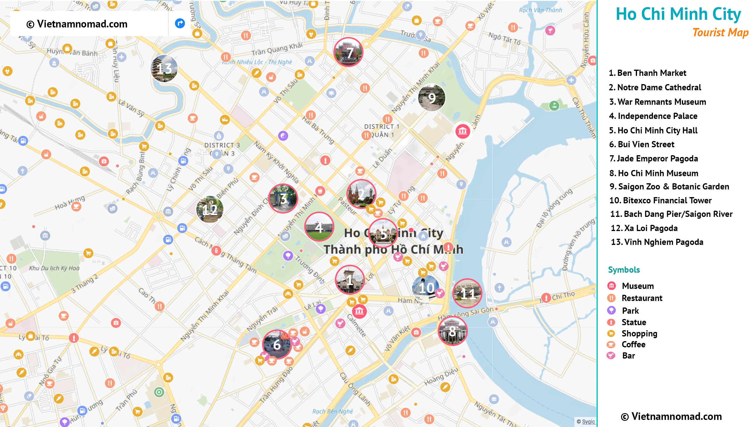
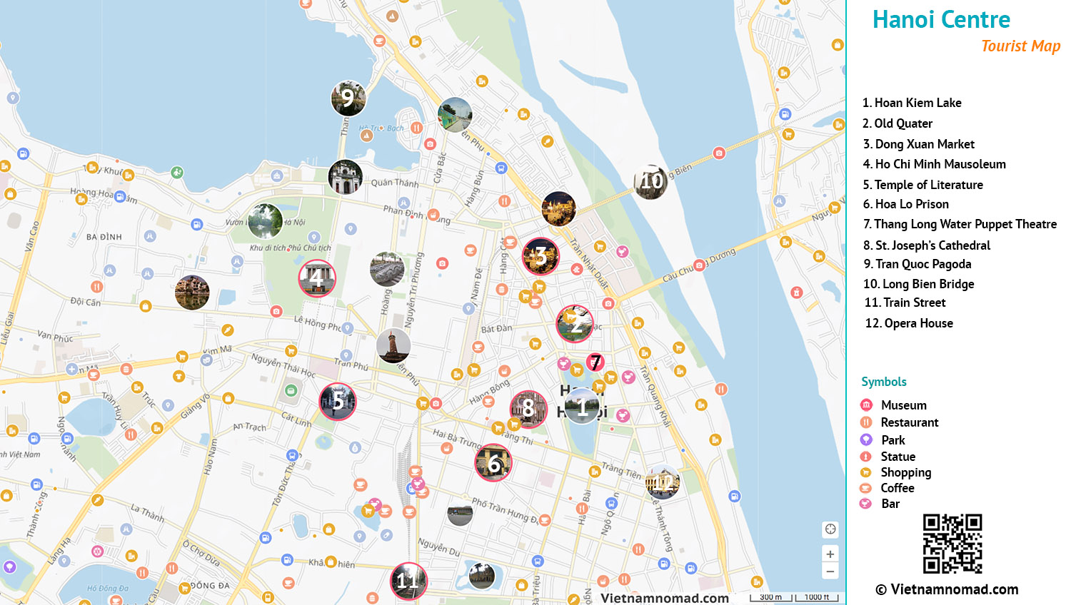
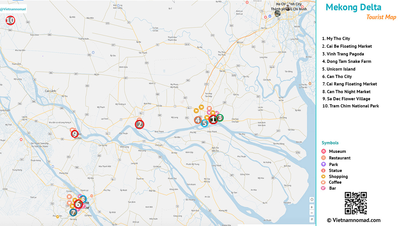
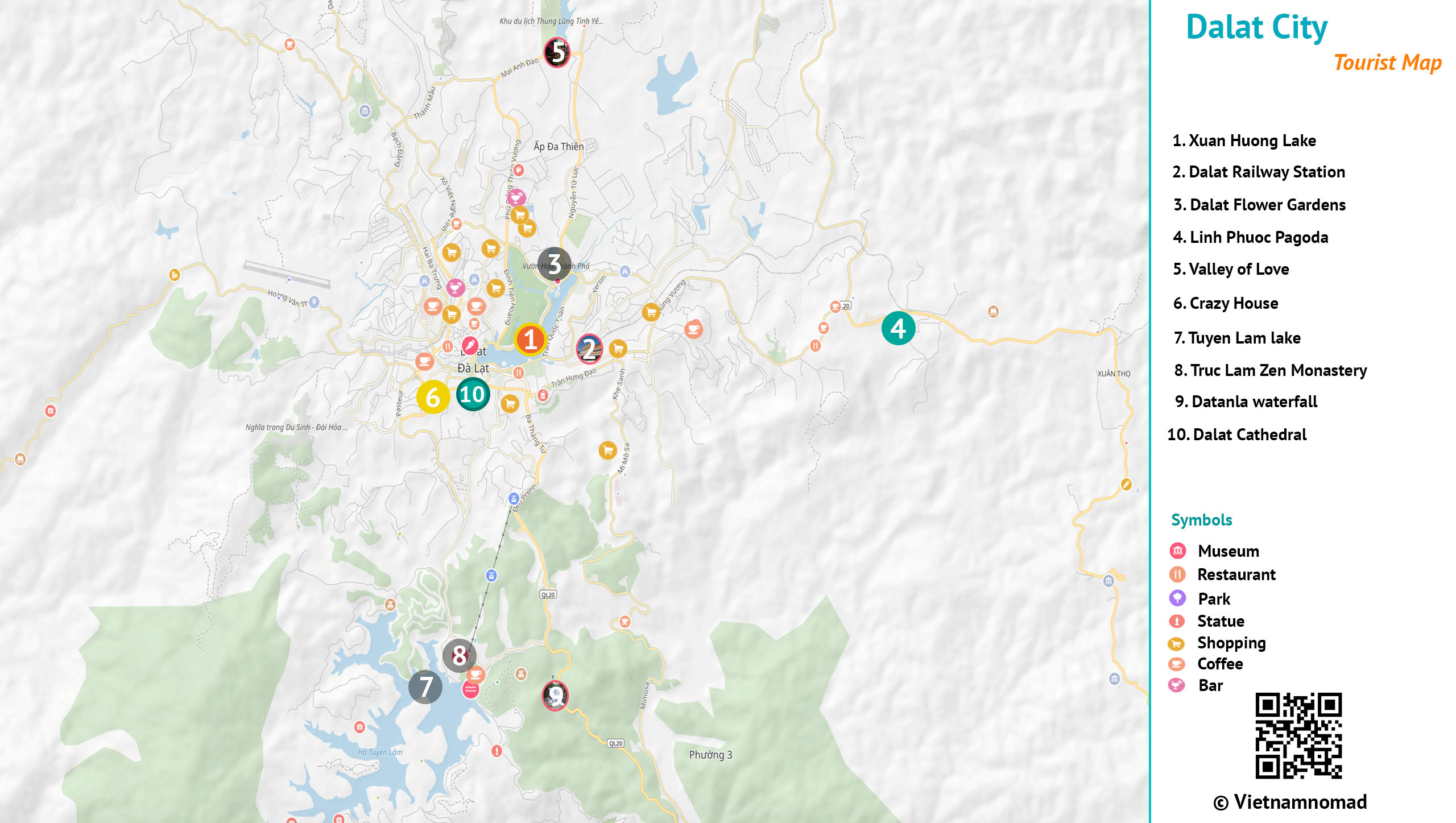
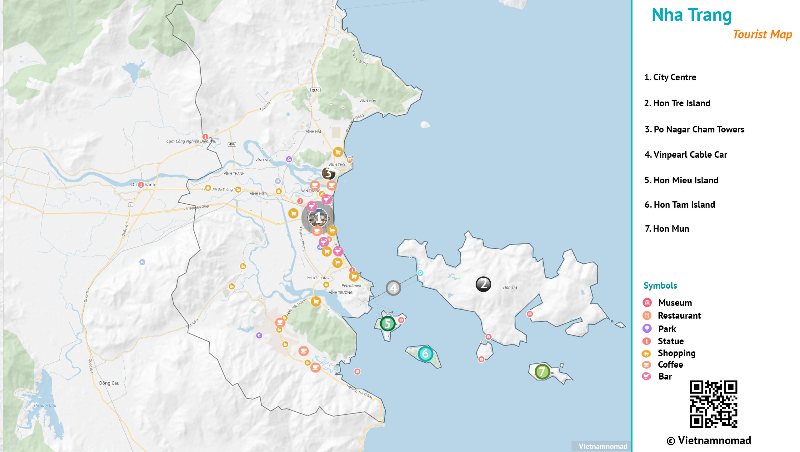
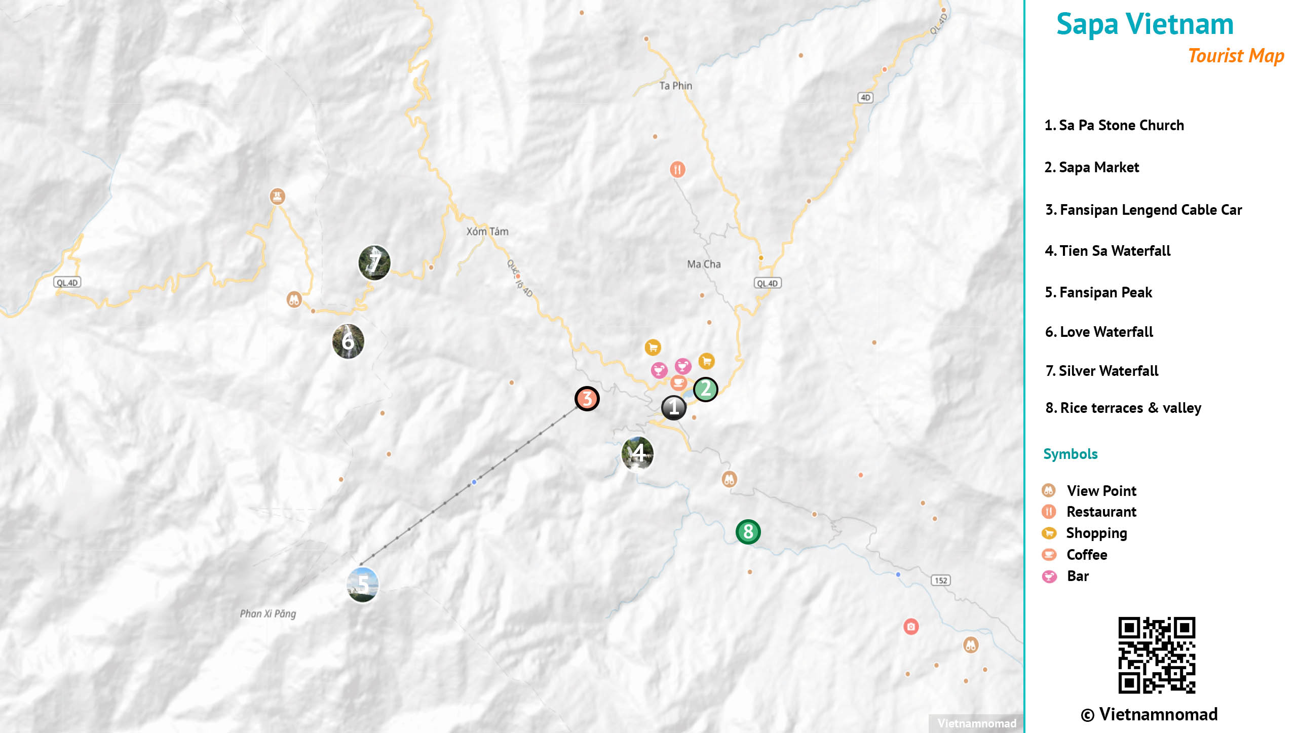
City maps of Vietnam
Tips
- You can type the names of our maps into AI•Companion to download high-quality PDF versions for offline use or printing during your trip. This feature is available with the Pro plan.
- Join the Welcome to Vietnam Membership program to enjoy exclusive partner offers and make your trip more budget-friendly.
- Check out our month-by-month Vietnam weather maps to get an overview of the weather during your trip and plan more confidently.
Note
These maps are intended for personal travel use. While they may be helpful as general reference, they are optimized for tourism and may not match official or scientific accuracy.

